Smokey Mountain 2-Day Epic Ride with a Campervan Rental
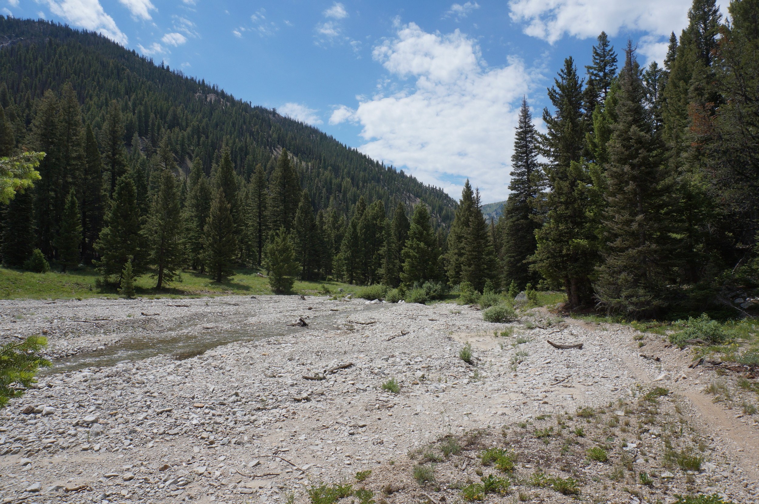


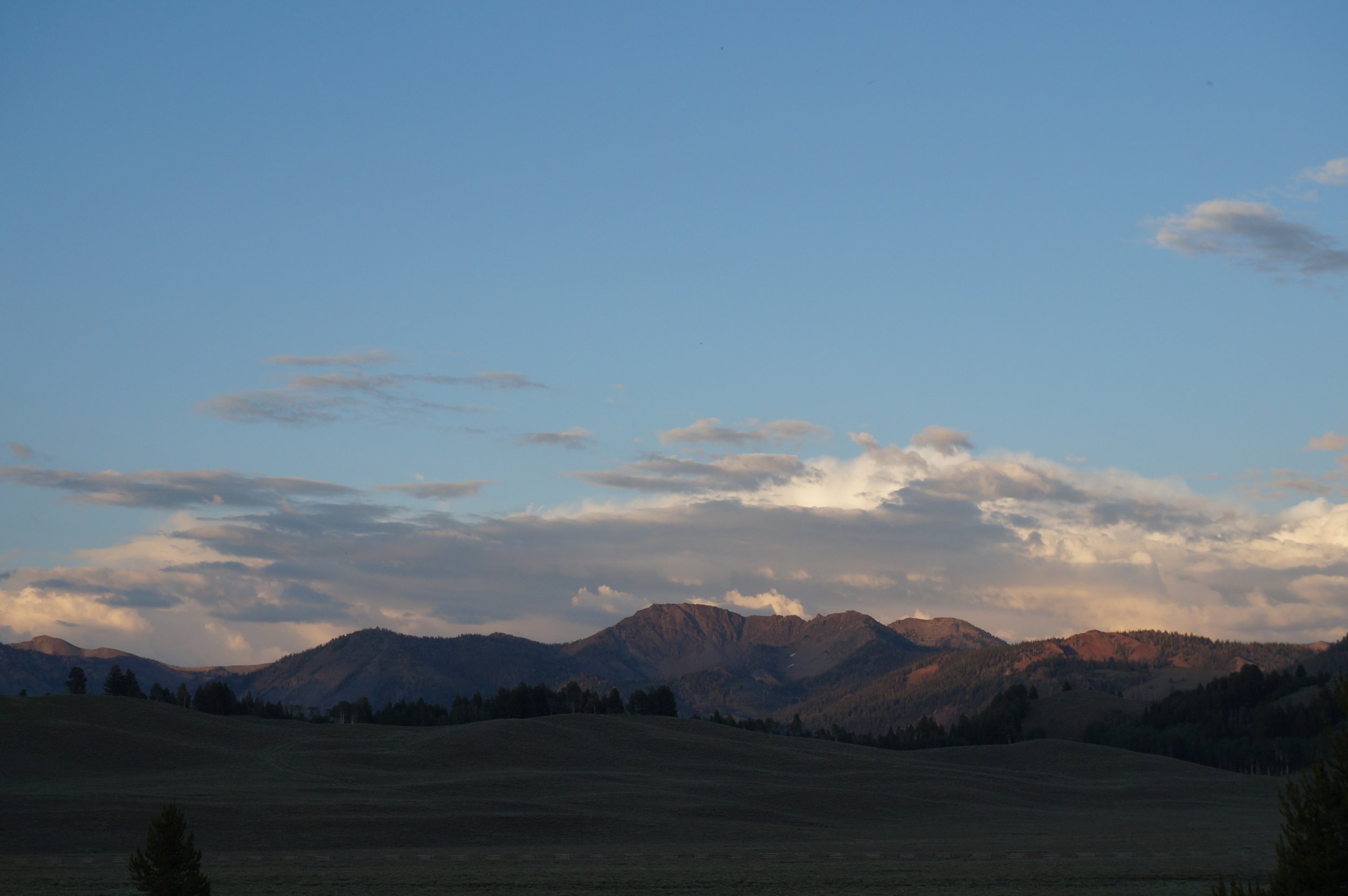


One winter day my wanderlust for a big ride kicked in and the maps came out. After poring over the maps we came up with a goal of riding from Featherville to Smiley Creek Lodge and then back again. Big Smokey is the crown jewel of the trails in the Smokey Mountains, 18 miles of singletrack tucked into a valley that is surrounded by roadless forests. The trick was finding a way to the start of Big Smokey. After lots of research we settled on using the South Fork Road and Emma Creek. So on July 12th I met up with Tayler in Fairfield and then we drove into Smokey Junction in the Smokey Mountains.
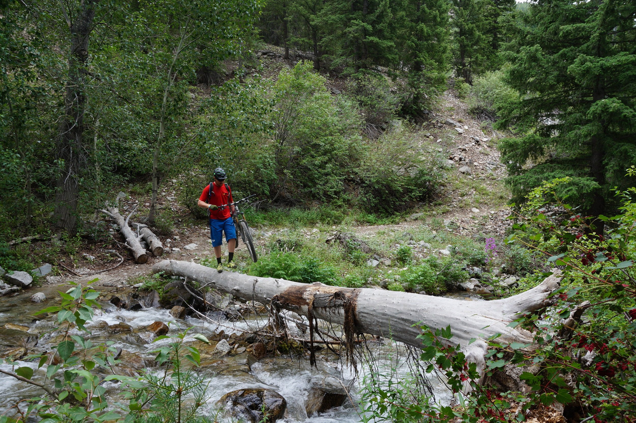
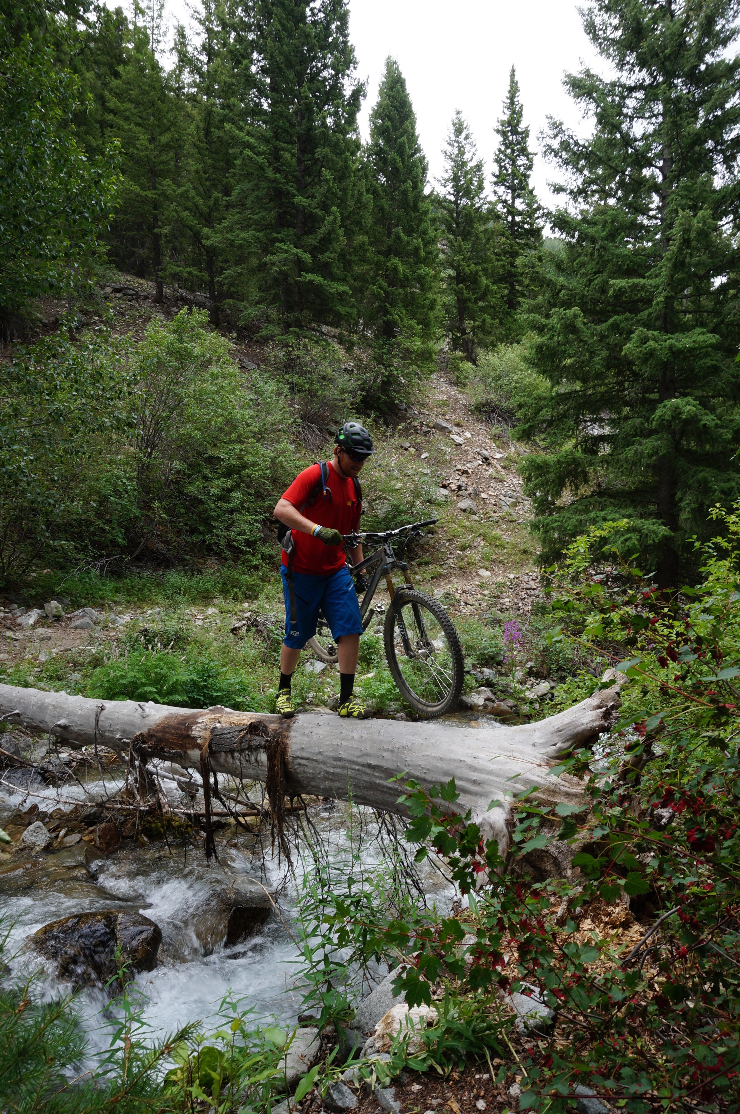
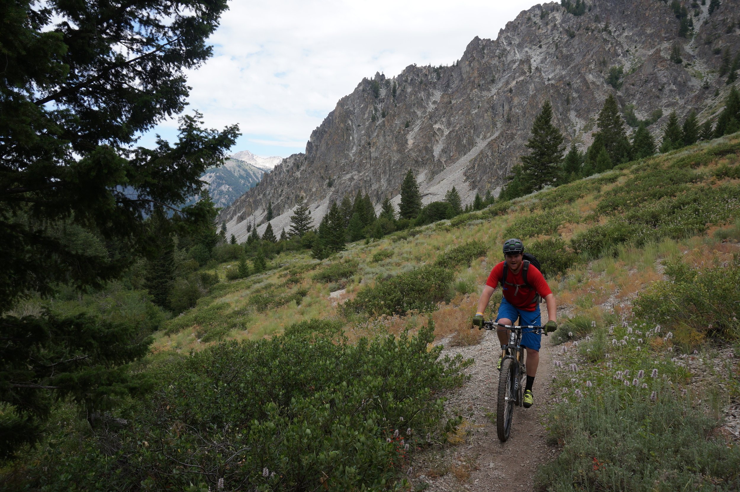
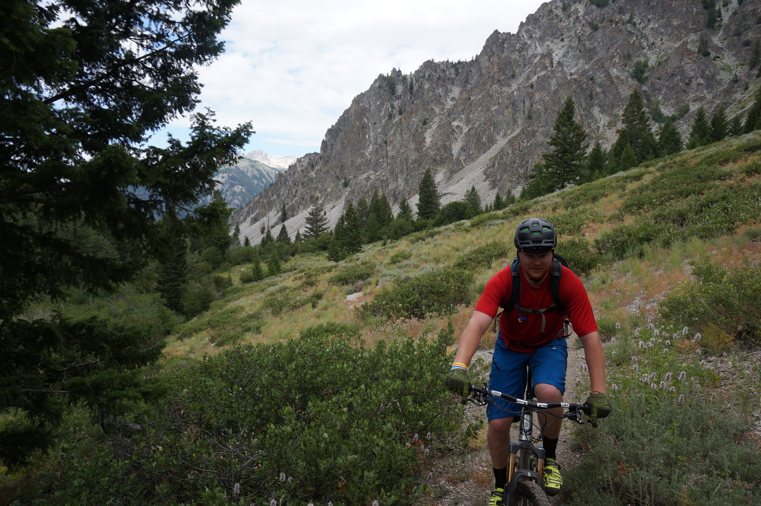
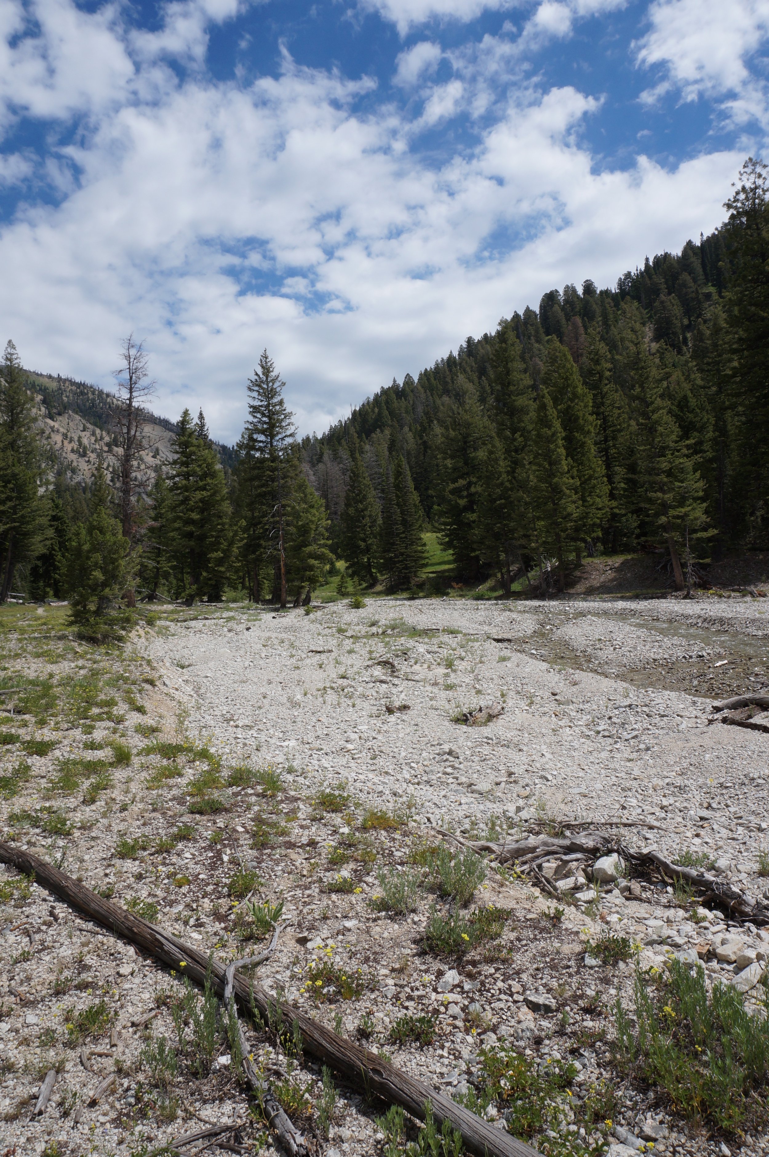
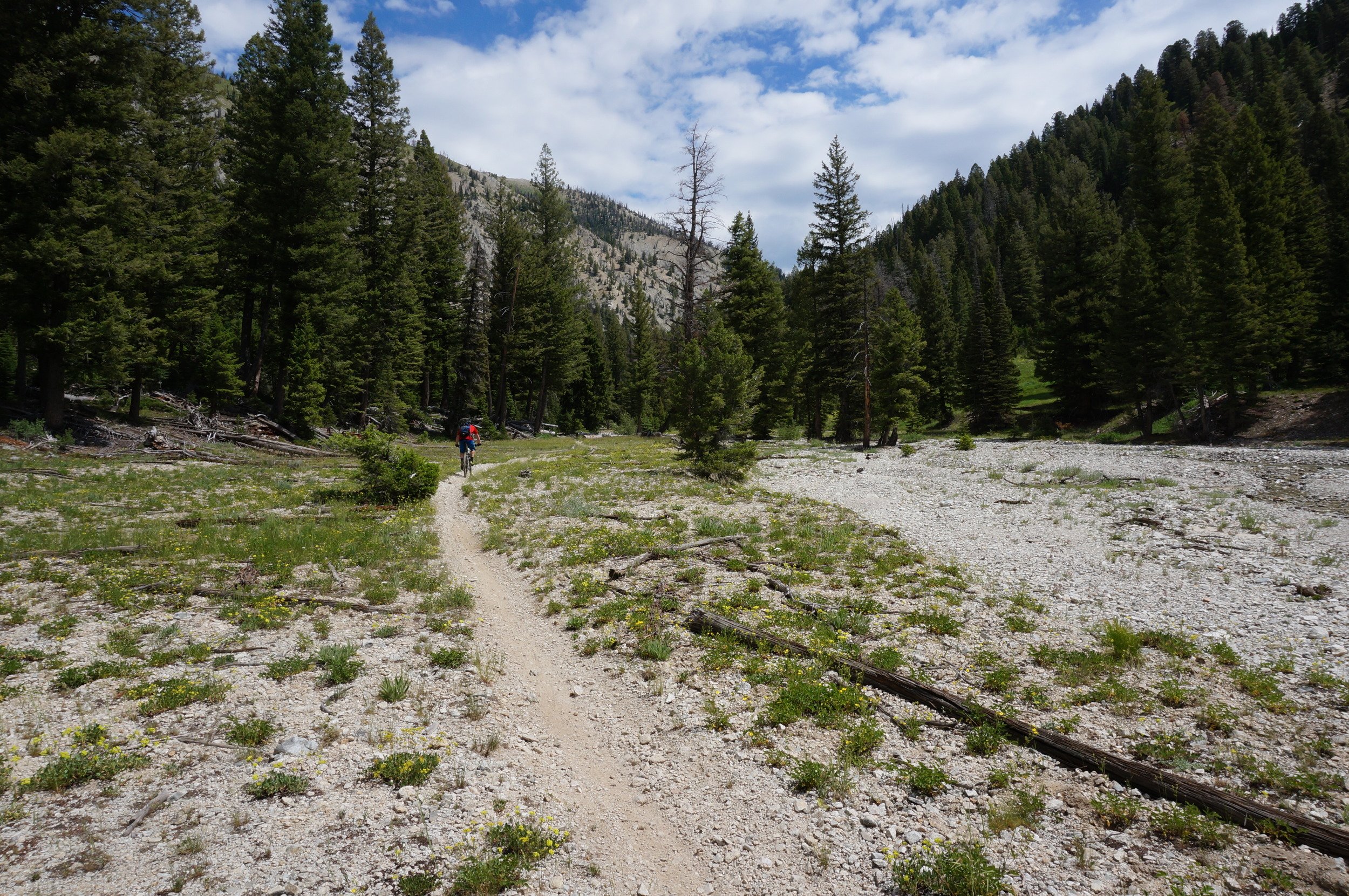
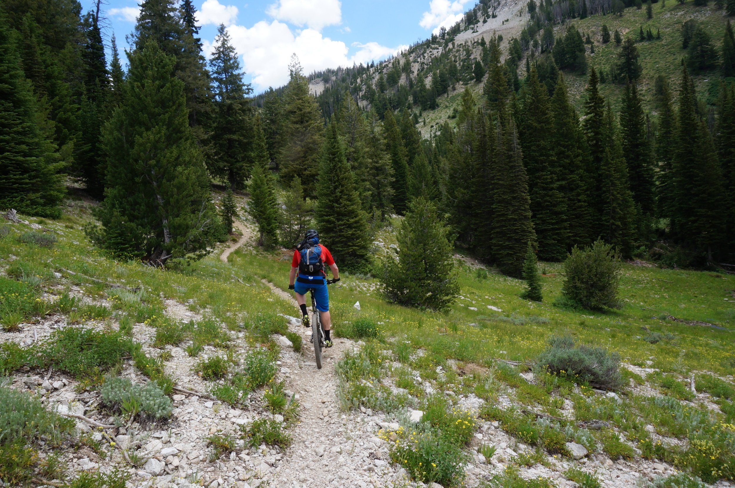
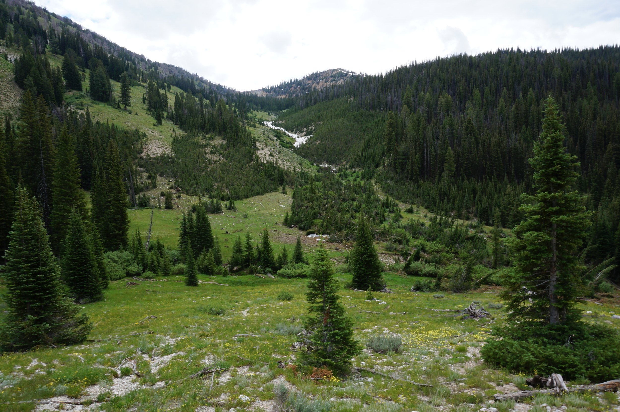
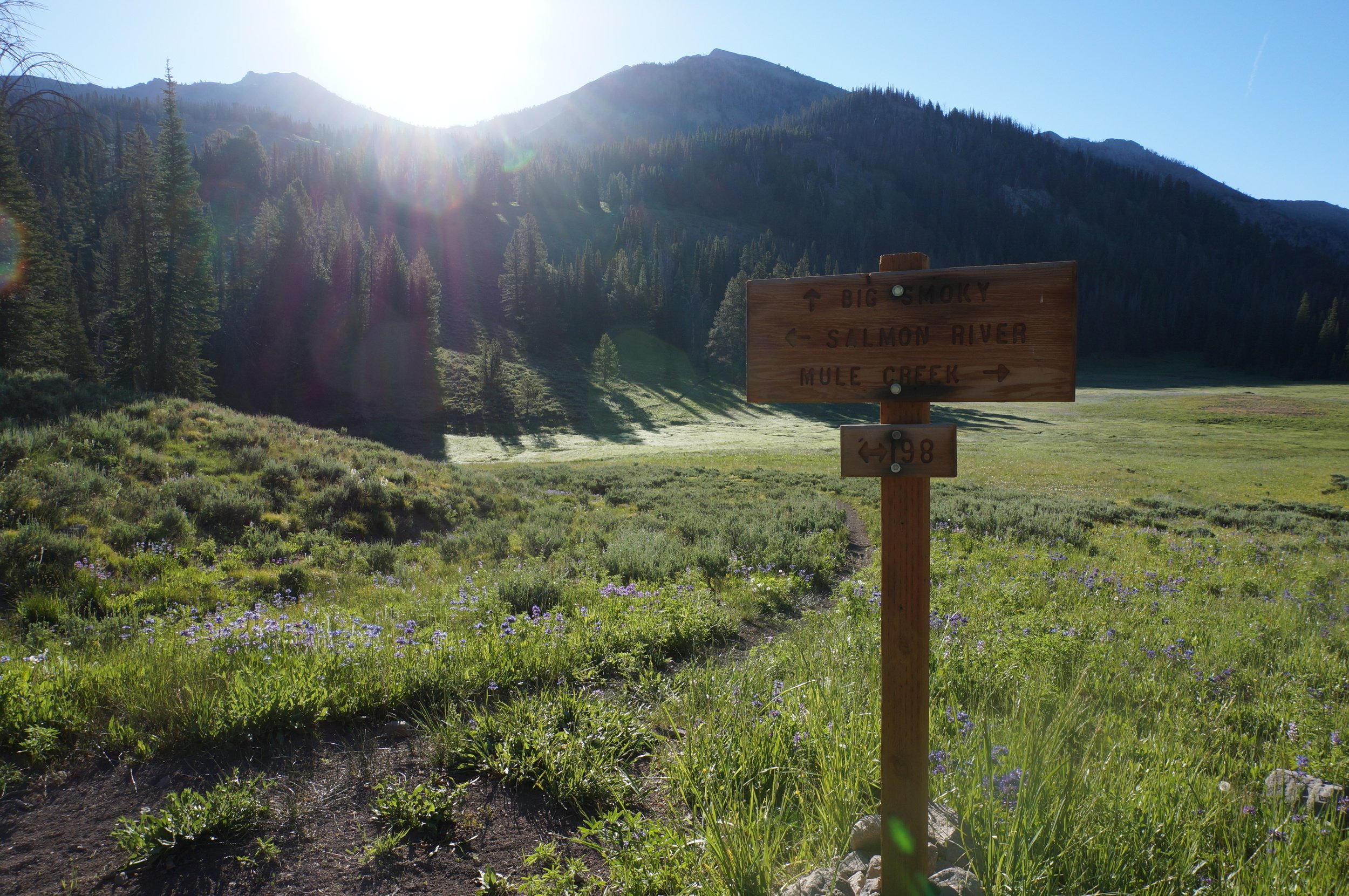
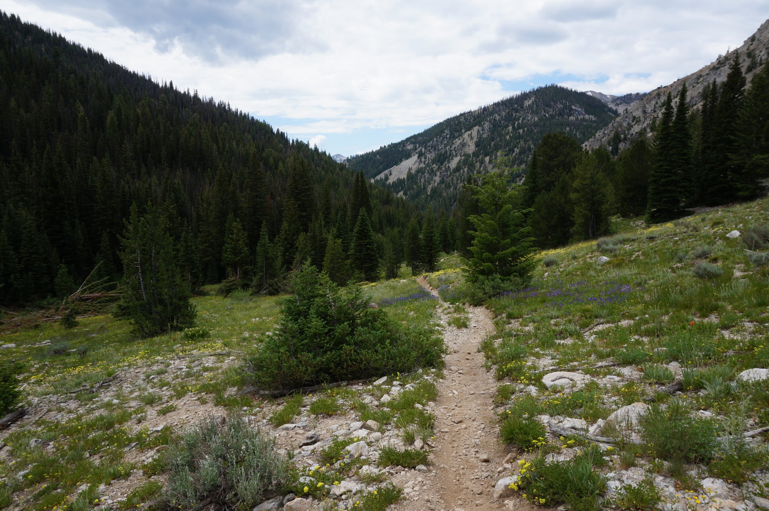
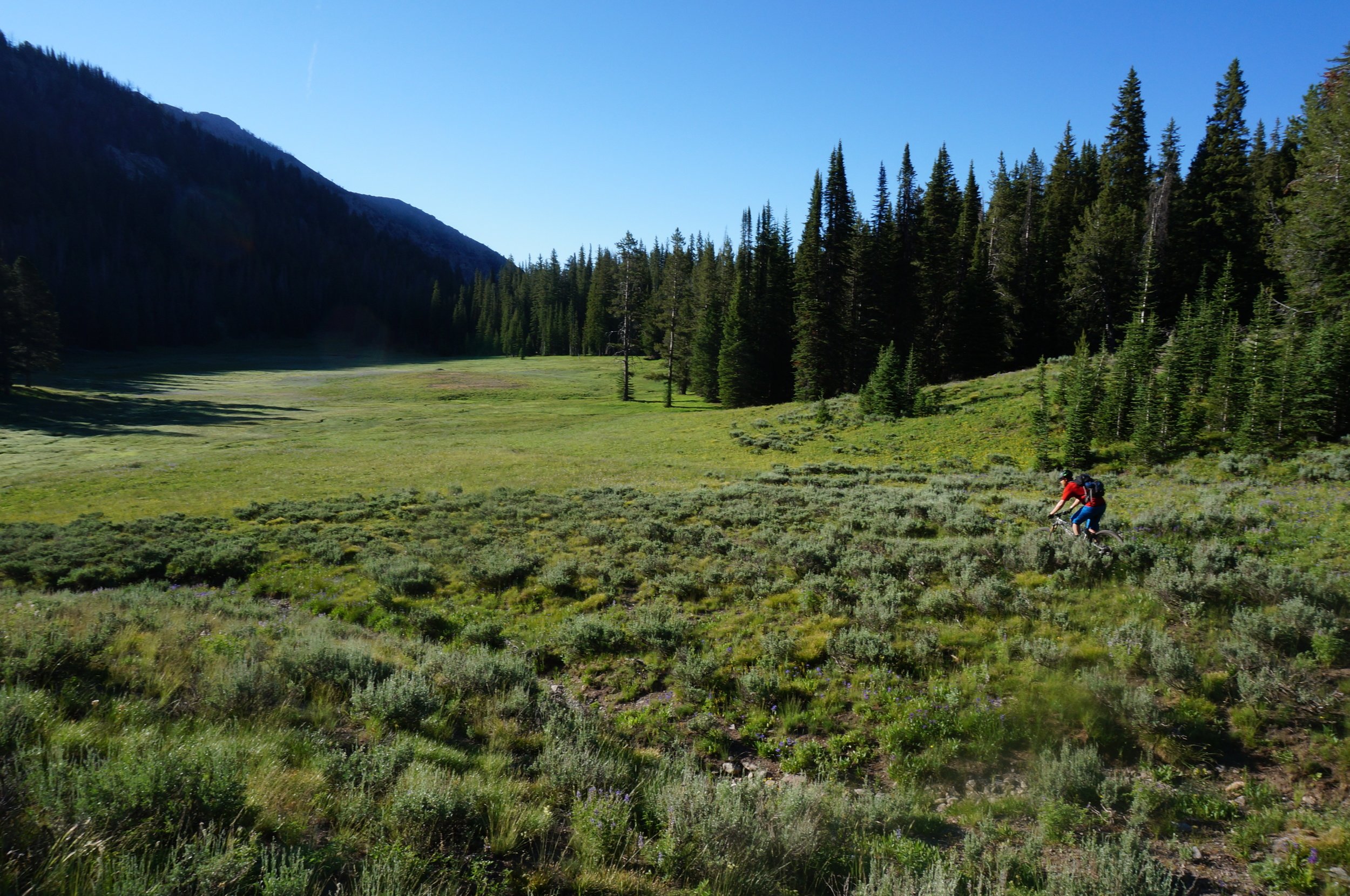
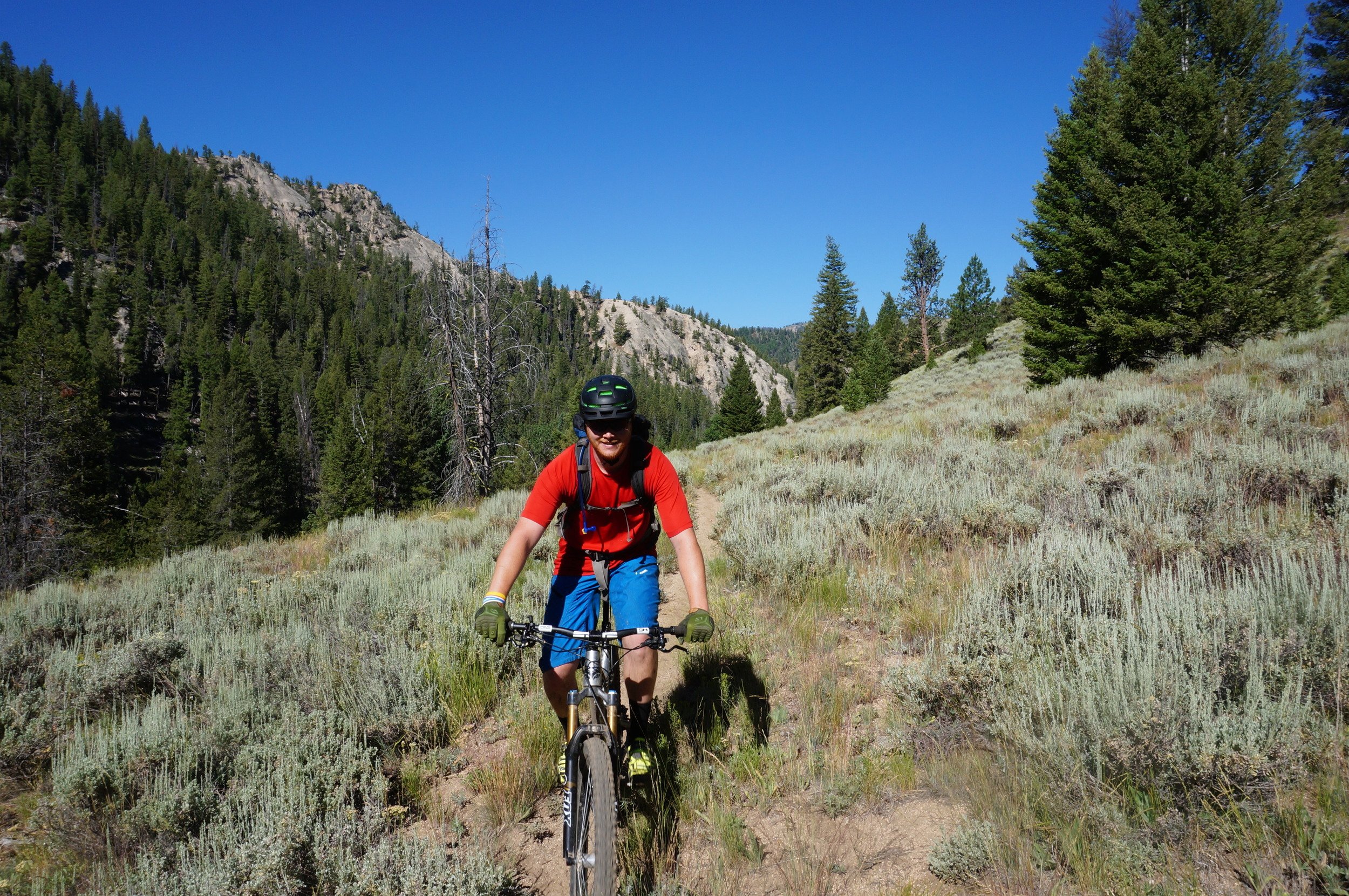
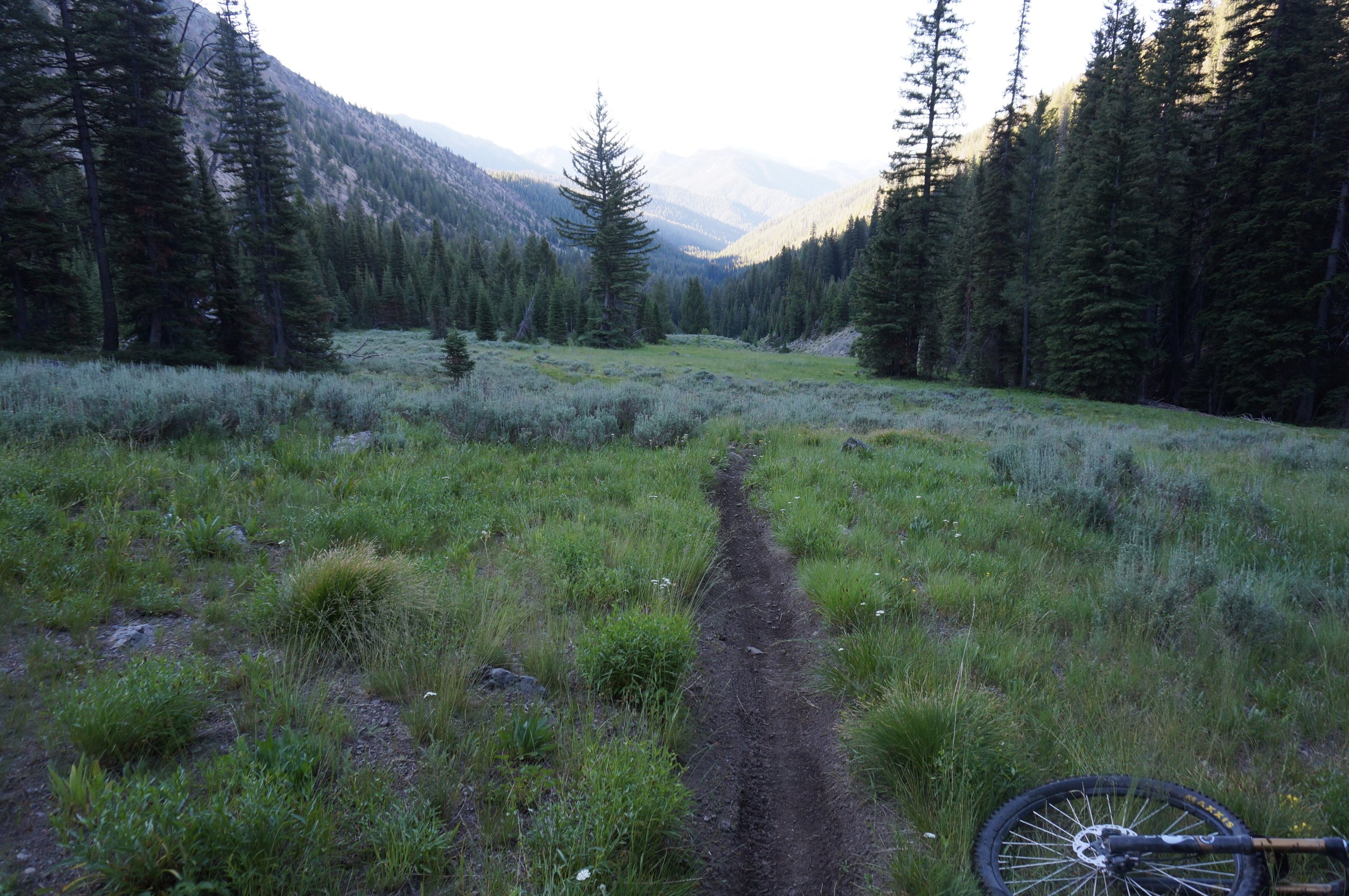
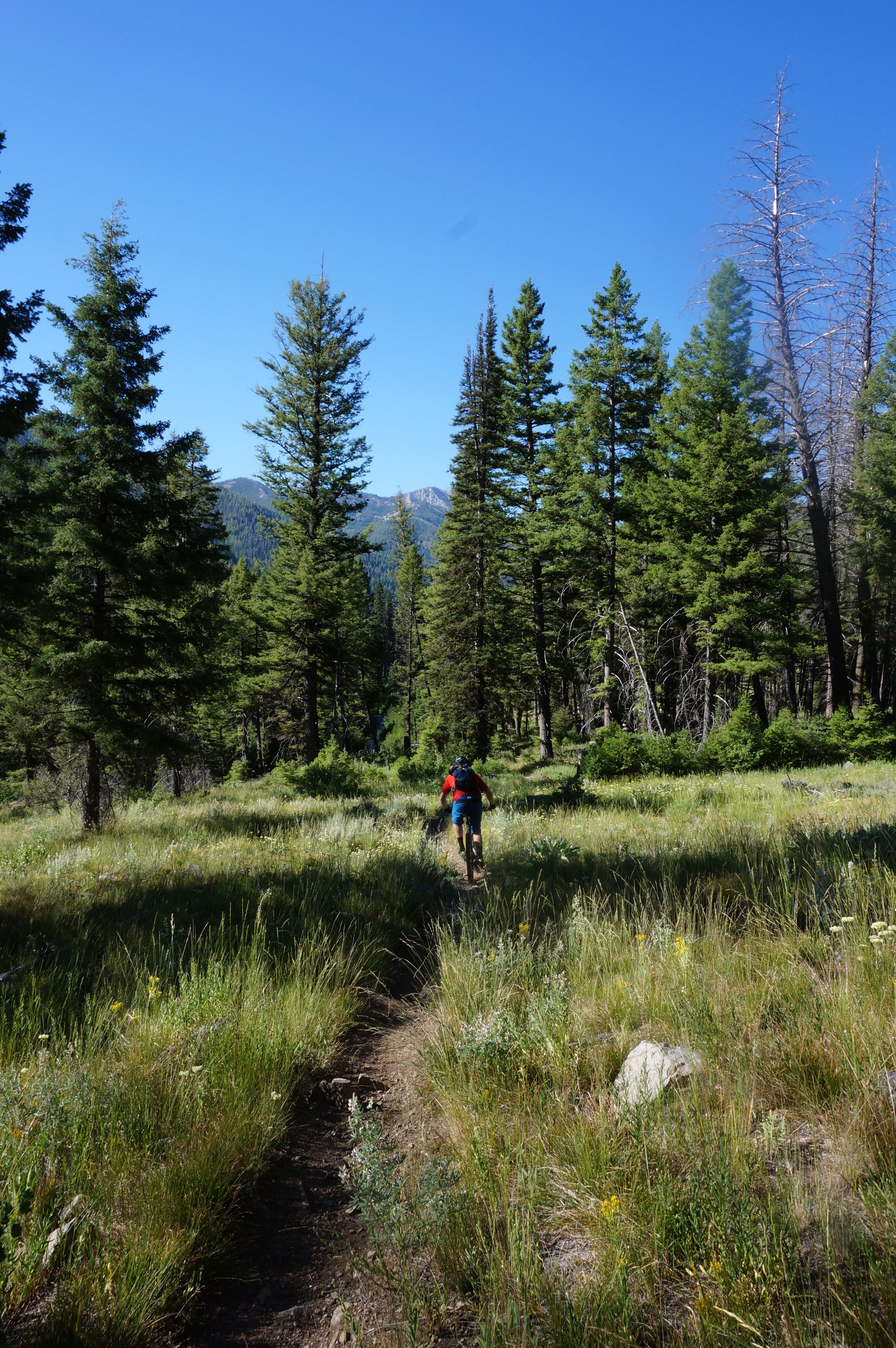
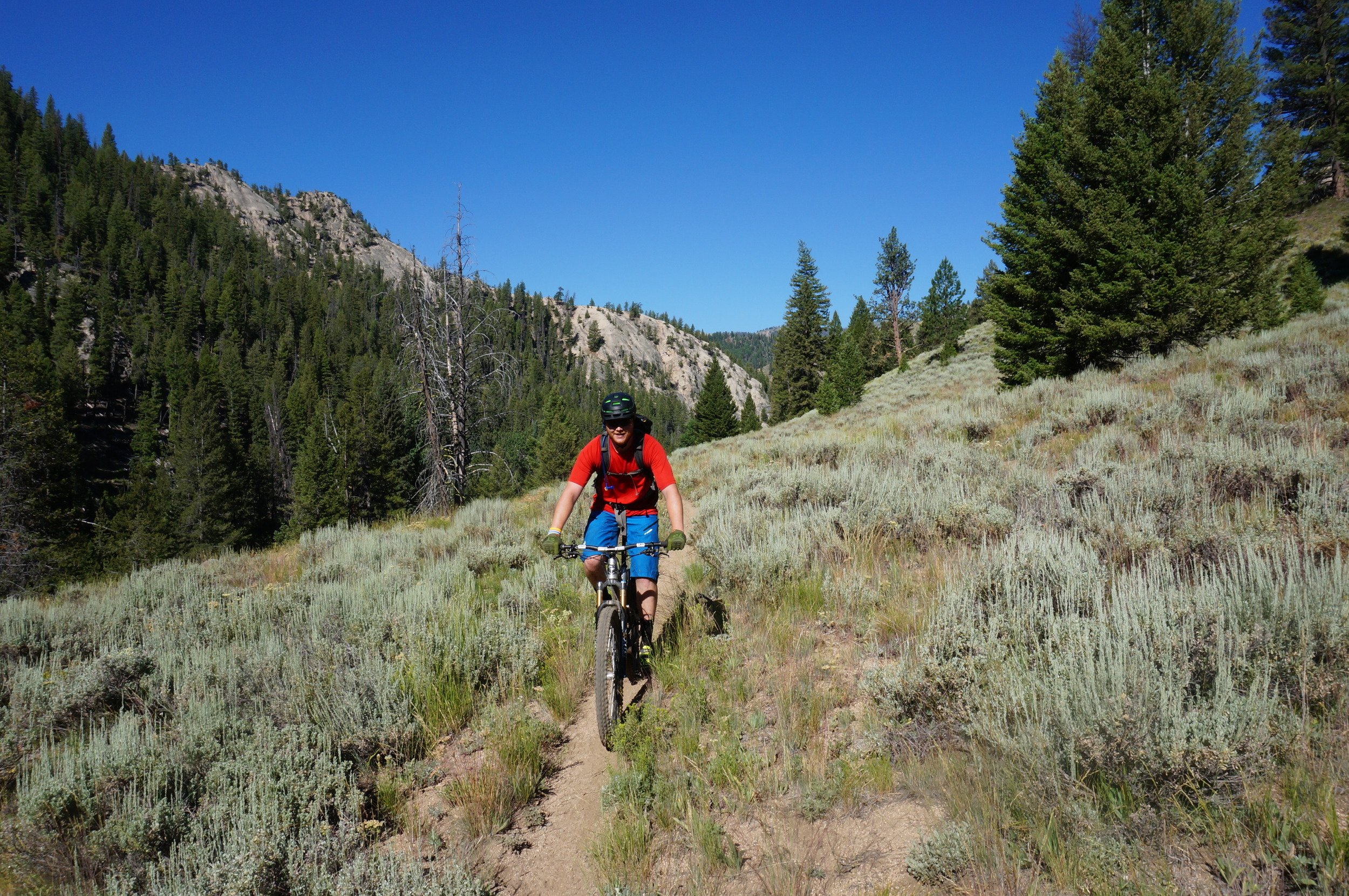
We unloaded our bikes at Smokey Junction and checked through our gear. I zip tied on a pair of sandals to my handlebar and put my change of clothes in my pack. Tayler was cursing the fact he had left his rain jacket back in Fairfield as the clouds off in the distance looked a little ominous. We decided we were as ready as we could be and set off down the road. The first climb is on the South Fork of the Boise road to Fleck Summit and this went by at a leisurely pace. As we descended of the summit we knew we were becoming more committed to the loop. The South Fork continued to be in great shape and we ticked off the miles while taking in the surrounding mountains. After about 10 miles on the bike we came to an abrupt change as the road went from wide and smooth to narrow and rocky, but this was a good sign. After a mile or so on the rough road we came to our trail junction with Emma Creek. From here we had over 3000ft of climbing in about 5 miles. Emma creek started off steep and loose and then the trail narrowed up and we were back on our bikes slowly climbing. We got to our first creek crossing and debated getting our feet wet as we looked at a log sitting 6 feet above the river. We decided to go for it and walked slowly across the log with bikes in hand and were mighty happy when we reached the other side. The trail continued to pitch up and we alternated between pushing and riding. The trees parted and up ahead we looked across a massive talus field. The mountains were majestic and we were amazed at the trail that picked its way through the rocks. There were a couple over the shoulder carry spots, but overall we made good time across the talus. At the other end we looked back over the rocks and then the peaks that formed a spectacular valley. Happy to back on dirt and riding along we stopped for lunch near an avalanche still melting out. After a quick bite we continued the climb and came across some Idaho Trail Rangers doing trailwork from dirt bikes. We thanked them for the hard work and were on our way, not realizing these would be the only people we would see on the trail during our entire ride. The mountains steepened around us and we knew we were going to be in for a big climb very soon. Sure enough the trail pitched up as we passed an old landslide that had carved a 100ft path of destruction down the mountain. We took a quick look at the map and settled in for 800ft of hike-a-bike. The trail was steep and washed out as we pushed higher and higher. Finally an old mine appeared on our left and we knew we were close to the top of the pass. The trail broke out onto an old mining road and we pedaled up to the saddle. All around us lay the remains of mining from the 1800s that was being swallowed up by the forest. At the pass we laid down and let our bodies adjust to the air at 9200ft. After catching our breath we turned onto the West Fork of Big Smokey and were both hoping for as little climbing as possible. We were rewarded with a nice traverse and then turned down the hill. The West Fork of Big Smokey had seen some recent trail work that made the trail very swoopy and fast. The builders left a sea of stumps spaced just wide enough to allowed a bike to pass through. We picked up speed and then took turns in the lead. After all that climbing it was great to be blasting down a fast and flowy trail. The trail came to an end on Smiley Creek Road just at the right moment since our bodies were starting to feel the fatigue of the day. An easy cruise down the road led us out of the tight mountain valley and into the big open valley and views of the Whiteclouds. We ticked off the miles and arrived at Smiley Creek Lodge very dirty. We laid our bikes against the lodge and walked in to check into our room. Once checked in we ordered up some amazing milk shakes and sat at the bar relaxing. Finishing up our shakes we headed to our room a grabbed some much needed showers. After getting cleaned up we both did a little laundry in the sink since we both packed very light and wanted semi-clean clothes for the next day. We settled in for a nice afternoon and ate dinner out on the patio refueling for the next day. Preparing for an early start we both climbed into bed around 9pm for a planned 6am wakeup. We awoke to the sounds of airplanes landing at the Smiley Creek Airstrip just across the highway. Getting an early start meant the restaurant was closed so we had to settle for some powdered mini donuts before heading out. The ride started on the highway and we easily ticked off the miles to the Salmon River Road. We turned onto the dirt and settled in for an early morning cruise up the road. We had to pick our way across the Salmon River before finally coming to the end of the road. At the end of the road with turned onto the Big Smokey trail and got ready for the final big climb of the trip. We had about 800ft more climbing until the saddle and the big descent. The trail was an old mining road with one narrow path that was not loose and rocky. At the saddle we felt great to have ticked off the final big climb. Now our 16 mile descent would begin. The trail starts in an amazing meadow that is part of the headwaters of the Salmon River. The Salmon River weaves through 425 miles of Idaho and reaches epic proportions in the Frank Church Wilderness, so it was pretty special to pedal across the little trickle coming out of the meadow. Once past the meadow the trail starts to switchback and descend furiously. Rocks and swooping turns were a blast as we descended and then started to get a little carried away. The grass suddenly got thick and then the trail disappeared along with the bike and we rolled into the grass with the bike firmly sunk into the mud. Luckily we had a nice soft landing in some meadow grass. That crash was the only unintended dismount of the trip which was a good thing, since we picked the softest place to land on the entire trail. The Big Smokey trail is located in a drainage that is surrounded by roadless lands with no escape. We continued descending and picking our way down the mountain. The first four miles of the descent went by fast and we flowed through the trees and over the rocks and then things started to slow down a little. The trail flattened out a little as we proceeded to go up and down small rises. The trail also started to cross the river and our feet became ice blocks in the cold mountain water. This turned out to be the wet part of the ride as we ended up crossing the river and watching as the water came up higher and higher on our legs. After some great technical sections we came to the Junction with the West Fork of Big Smokey and sat down for a snack. We had descended almost five miles and were unsure what the next 10 had in store for us and our bodies. Luckily we crossed the river for the last two times and ended up on the west side of the river. The trail had some amazing variety and scenery. There were super technical rock sections followed by fast and flowy sections with some short ups. Even though someone had cut some trees out earlier in the year we still had a couple trees to hop over, but none of them broke up the flow of the ride. The trail came close to the river and we thought for sure we were going to have a crossing, but luckily the trail had been rerouted to stay on the west side. We admired the trail builder’s handy work as we climbed about 200ft above the river. Descending the new trail section we looked over across the river and were glad we did not have to cross again since it was easily waist high now. The trees seemed to get bigger as we picked our way down the trail and we came to more fast sections tucked under the big trees. With about five miles to go the trail started to open up and the trees got scarcer and the sun got more intense. We passed a hot spring along the trail and just could not bring our selves to stop since we were not sure how it would feel to get back on a bike after a nice relaxing soak and we were a little worried about the forecasted temperatures. We continued onward and rode through more sage brush and open areas until we came to an option. There was a sign for a low and high trail. The high trail looked to have another 300ft of climbing to get above a cliff band versus the low trail which crossed the river. We decided against the low trail since the river had looked so raging earlier. We settled in for the one more climb. Our bodies were a little tired after close to fifty miles of riding over two days so we ended up pushing some of the steeper sections we surely could have ridden most other days. At the top of the climb we looked down the cliff onto the river and out over the ever expanding valley. The descent off the climb carried us the last couple of miles back to the car. As we reached the end of the trail we gave a cheer and though back about the 18 miles of amazing singletrack. No mechanicals and no major crashes to slow us down put us at our cars just before noon after a 6:30am start. All of the vision and planning created an amazingly memorable ride. The Smokey’s are truly an amazing place to ride with miles of remote singletrack to explore.
#campervan #rv #recreational vehicle rental #vanlife #wanderlust